
Overview
The Sand Pass project is located in western Utah along the east-trending Tintic-Deep Creek Mineral Belt.
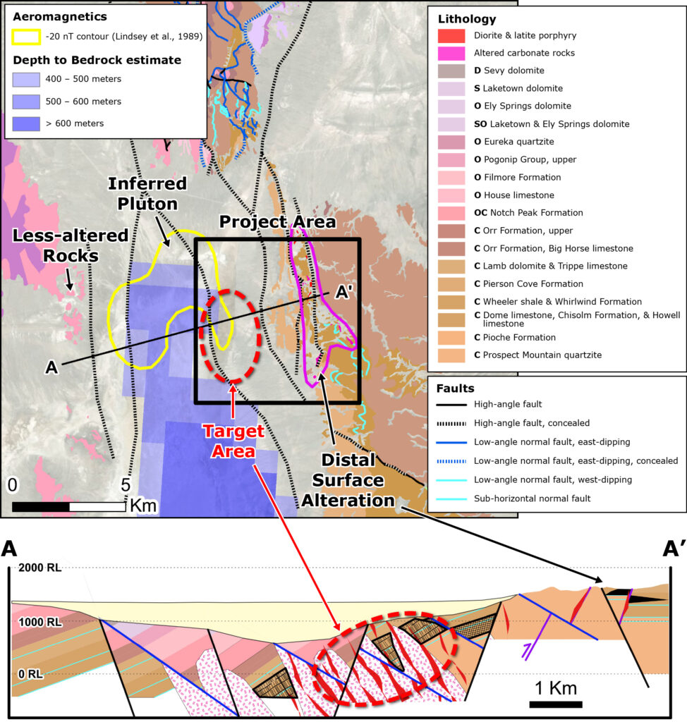
Surface alteration-mineralization and regional geophysics support the hypothesis of a porphyry system concealed beneath ~200-500 meters of post-mineral alluvium. Jasperoid and ankeritic dolomite are dominant alteration types, with less-reactive quartzite, which likely masks the alteration vector to the west. Distal Au-enriched jasperoids at Sand Pass may be analogous to the Barneys Canyon and Melco deposits at Bingham Canyon, located 150 kilometers northeast of Sand Pass.
Historical drilling from 1978 to 1987 focused on outcropping distal alteration. Regional magnetic surveys and compilations all show a magnetic high under the north end of Tule Valley, which was interpreted as a buried intrusive by previous workers. Regional gravity surveys indicate that the depth-to-bedrock in the project area is less than 600 meters, and should be as shallow as 200-300 meters.
Nearby mines and deposits provide context for the project, but do not necessarily indicate similar size, styles or grade of mineralization within the project.
Project Gallery
(click to enlarge)