
Overview
The Tango project is located in western Nevada, ~200 kilometers southeast from Reno, and is comprised of Bronco Creek and Great Western Mining claims held under a pooling agreement. The historic Eastside mine area (Circa 1910s), which targeted Cu-Ag mineralization, lies to the southwest of the Tango claims.
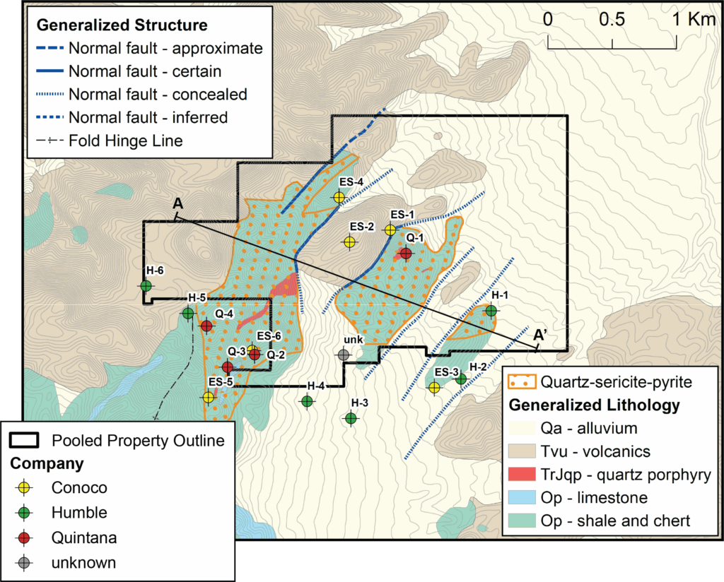
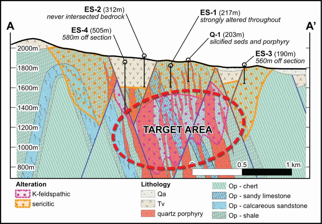
Widespread sericite-pyrite alteration and locally abundant quartz veins and CuOx mineralization indicate a porphyry Cu-Mo system at depth. The alteration is interpreted to represent the pyrite halo, with the higher-grade potassic core yet to be found. The large (~2 x 2 kilometer) alteration footprint is partially covered by post-mineral Tertiary volcanics and Quaternary alluvium.
Historic drilling by Humble Oil, Quintana Minerals, and Conoco was done in the 1960s-1970s, though much of this data is limited. These companies explored the project as a porphyry Cu target but failed to test the system due to shallow drilling and/or because holes were located outside of the main alteration zone. Conoco recognized that a larger porphyry stock was at depth and that additional, deeper drilling would be required to locate this.
Soil geochemistry, rock chip geochemistry, and geophysical surveys (IP/Resistivity) have also been completed at Tango.
Nearby mines and deposits provide context for the project, but do not necessarily indicate similar size, styles or grade of mineralization within the project.
Note that many of the drillholes are outside of the main quartz-sericite-pyrite alteration footprint.
Project Gallery
(click to enlarge)